Paradise displaying Europe data.
Description of the Europe data.
NOTE: Document is under construction.
The database for this sample consists of the following extents :
- Land : Consisting of polygons that represent the contours of
the land masses of Europe.
- Borders : Consisting of polylines that represent the national
boundaries.
- Lakes : Consisting of polygons corresponding to the lakes in Europe.
- Cities : Consisting of city name, country name, population and the
geographic location of the city.
- Rivers : Consisting of polylines corresponding to the rivers in Europe.
The projection system used here is LAEA with the center near Berlin.
This data was got from the folks working on GEO++ at The TNO Institute
of Perception, The Netherlands.
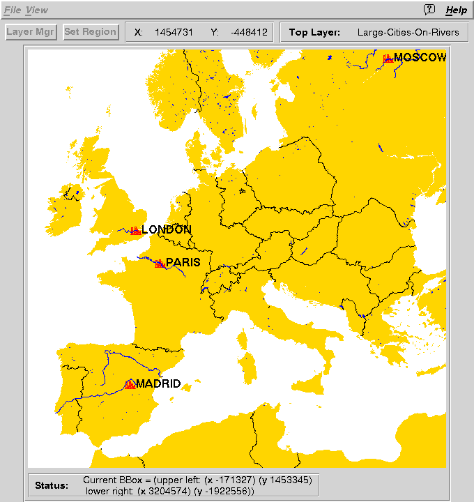
This
snapshot shows the results of a query being displayed on the
frontend. The query is :
select city.country, city.name, city.population, city.geo_loc,
river.geo_pline from city, river
where city.geo_loc overlaps ##PDMAP##
and city.population > 3000000
and river.geo_pline overlaps city.geo_loc.makeBox(500)
This query performs a "join" between the cities extent and the river
extent. The query selects all the cities that are in the area being
viewed (##PDMAP## is automatically substituted by the front-end for
the coordinates of the area under display) that have a population
greater than 3M, makes a box of side 500 units around the selected
cities, and finds all rivers that overlap with the constructed boxes.
The display shows the result tuples of the join (color red). The name
attribute of the city is used for labeling the result tuples. The
background in the display consists of the land data (color gold), the
borders (color black) and lakes (color blue).
(Disclaimer: The map is for the purpose of demonstration only and some of
the political boundaries may no longer be correct)
Date Prepared:
13 June 1994
Jignesh Patel / jignesh@cs.wisc.edu.